
Wanderlust is a common feeling not only for the millennials but for everyone in general because there is always a sense of curiosity on how’s the grass on the other side. While traveling is a great cure for wanderlust, not all are mobile or well enough to commute long distance to their dream spot.
Besides that, a certain level of fitness is required in order to perform more physical activities such as skydiving in Philadelphia, diving in Costa Rica or scaling our very own Mount Kinabalu. As such, it is easy to miss out on these picturesque views, and literally out-of-this-world experiences.

In Malaysia, we are blessed to have an abundance of spell-bounding views inclusive of the highest mount in our country—Mount Kinabalu. It is a beautiful place but not many are able to get a chance to hike it all the way to the top. Due to this, we can only rely on photographs to satisfy our cravings for travel.
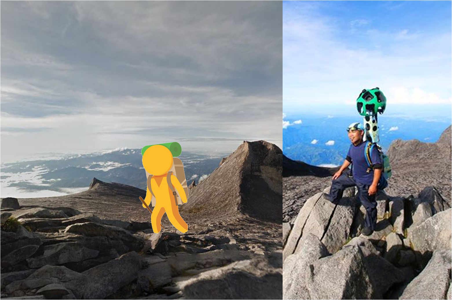
However, to capture moments on the summit of a mountain is certainly no simple task at all. In order to get a street view location of a place, one must utilise a Google Street trekker and the device itself weighs close to 20kg! That is why Google Street View imagery is usually created by mounting the street view equipment on a vehicle, typically the roof of a car.

Inside of buildings, the data recording device are placed on trolleys; and in Venice, the canals are photographed from boats. In efforts to capture the beautiful imagery of Mount Kinabalu on Google Street View, the device was strapped onto a mountain guide—imagine lugging the equipment on one’s back!
Malim Gunungs, otherwise known as mountain guides, are what one would consider the expert hikers and they are also the ones responsible for snapping Google Street View shots of Mount Kinabalu. After having launched recently, this picture of a Malim Gunung carring the Google Street View data recorder has just went viral on social media.
Over 1000 people have liked the photograph of a Malim Gunung carrying a Google Street trekker on his back, and a huge smile plastered on his face. The picture also received more than 300 shares and has plenty of comments positively praising the Malim Gunung’s efforts.

Facebook user Rena Joan added her comment to the post stating: “Cool! Finally I can ‘climb’ the mountain with my 2yo son! TQ.”
As Mount Kinabalu had a bad hit from the earthquake that occurred in June this year, this showcase of the mountain on Google Street View is the perfect way to immortalise it for every person to appreciate its majestic beauty.

Street View Operation Lead for Malaysia, Indonesia and Thailand, Nhazlisham Hamdan said, “We want to showcase the beauty of our own country and attract more visitors to visit and enjoy Malaysia,” adding that Street View now covered 80 per cent of East Malaysia and 90 per cent of Peninsular Malaysia.
Do you want to scale to the highest point of Malaysia, you can do so now without any hard work on Google Street View here.