We all know the frustration that comes whenever Uber rides begin with our drivers being unable to locate us.
I’ve personally experienced this for myself (for a few times now), and the apologetic drivers told me about the frustrations that come whenever their map gives them an inaccurate location pin for their pickups.
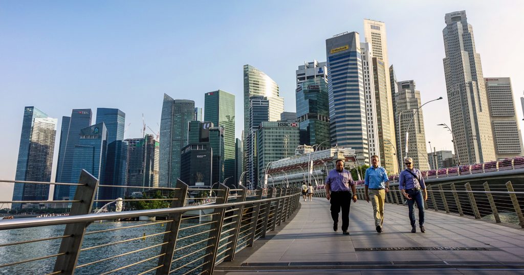
I also realised that this happens more commonly when I’m booking for a ride in the skyscraper-laden CBD.
Regardless, Uber is now planning to correct these with their mapping improvement efforts.
Mapping Singapore

Uber has just announced that as part of Uber’s global mapping project, Singapore will become “the first country in Southeast Asia (second in APAC, after Australia) to begin ‘passive collection’ of mapping imagery data”, starting from today (13 Feb).
Given that GPS and mobile maps are the lifeblood of the service, the American company wants, and needs to ensure that the data and maps they have are as accurate as possible.
Stating that while the existing maps are “a good starting point”, they found that some information are not relevant to Uber, like ocean topography (unless that is, they’re planning to go into uberSHIP or uberBOAT someday).
Citing the motivation for improvement coming from user and driver feedback, they will be focusing on the collection of traffic patterns and also precise pick-up and drop-off locations (hooray!). They would also look to improve the routing for their “innovative products like uberPOOL” and also giving users more accurate ETAs.
They’ve already started mapping the roads in the United States, Mexico, Canada, the United Kingdom, South Africa and Australia.
How Would It Be Done?
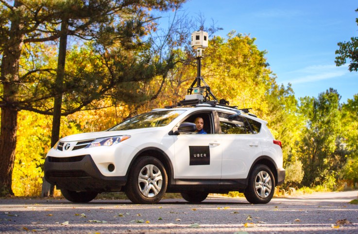
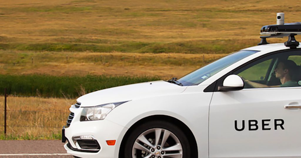
In hopes of capturing what current maps missed, they’ve equipped “several dozen” of their vehicles with mapping devices.
This is so that they can “collect the most important data — in places where Uber trips go — without putting more cars on the road”. The initiative is anticipated to last 2 or 3 months.
In the launch phrase, the drivers’ vehicles will simply be going wherever the trips take them, collecting mapping imagery along the way.
To ensure that they get imagery and data for all parts of a city, they also mentioned that they may deploy dedicated mapping vehicles before finishing up the entire process.
However, they have also mentioned that no imagery taken from the rides will be made available to the public, and the mapping devices would not retain any imagery captured at initial pick-up and final drop-off locations.
For those who really don’t want any bit of their journey captured, though, Uber is allowing them to request that the images collected be deleted.
What Does This Mean?
In the short-term, this could mean more accurate pick-up locations for our rides, and less headaches for users and drivers.
In the long run however, this information could very well be used to give any of Uber’s future ventures a cut above the rest, in terms of navigation and reliability.
Given that Singapore has been called to be a “place of firsts” for Uber (we were the first Asian country to get uberX and uberEATS), the move to map the whole of our country is also pretty logical – especially given the relatively smaller land area they need to work with.